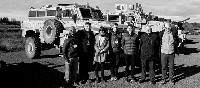
The future is self-driving, but autonomous transport is about much more than just making sure that vehicles keep to the road and do not run into pedestrians. What happens when we move away from the well-defined road ways cut through the landscape by the asphalt? There is no pre-defined best route off-road, and a vehicle has a lot more to learn if it is to find its own way and predict and plan its route. Aarhus University is taking part in a major NATO project to look more closely at this by developing stateof- the-art mobility technology for when a vehicle heads off-road. The project could ultimately save lives.
July 1917, Ypres, Belgium. The 1st World War is raging, and on the Western Front Field Marshal Douglas Haig and the allies are planning to retake the town of Passchendaele from the Germans. The plan is to break through in Flanders and bring the war to an end. Haig had promised victory. But the Battle of Passchendaele instead became a synonym for the full horror of the 1st World War. It epitomised the slaughter of the trenches, and half a million soldiers paid the highest price in this “Battle of Mud”, as the battle was dubbed.
More than a century later, we are still struggling in the mud when we move off the asphalted infrastructure our society has built.
It is still difficult to design vehicles that can cope with all the different types of challenging terrain in the world. For example when farmers have to drive over ploughed fields, or when military vehicles have to drive through mountain ranges to secure peace.
Even the most hardy Land Rover grinds to a halt when the water content of the soil is too high, and soldiers are still losing their lives when heavy armoured vehicles move out into difficult and impassable terrain.
Aarhus University is participating in a NATO-led project, Next generation NATO Reference Mobility Model (NG-NRMM), which aims to introduce, standardise and demonstrate the latest 3D simulation technology that can predict the ability of a vehicle to move over certain terrain conditions.
“We’re trying to find out about the performance of different machines at given sites on the basis of all kinds of geospatial data such as ground inclination, soil type, water content as well as obstacles such as rocks, trees, ditches, buildings, etc. What’s interesting in the project is how the machines interact with soft, muddy ground: How can we best move on this type of ground, without getting stuck and without damaging the ground unnecessarily?” says Professor (Docent) Ole Balling, and he continues:
“This makes it easier to choose the right tire size and pressure, or the right caterpillars for the future off-road vehicles, taking into account the conditions they are to move in.”
He has spent three years working with NATO, including the United States Army, to develop, test and apply accurate and true-to-life modelling and simulation tools to update NATO’s somewhat outdated process for military vehicle mobility prediction that was originally drawn up in the years just after the second World War.
However, the prospects stretch much further,” says Ole Balling:
“When a farmer drives in his fields, he can see ahead and assess whether he’s on his way into a mud hole where he might get stuck. How can an autonomous tractor do this? When we talk about the self-driving vehicles of the future, we’re always talking about driving on asphalt. But there’s a huge difference between asphalt and off-road, and if we want a truly self-driving future, clearly we’ll have to take this into account.”
Asphalt is far more navigable than when you move out into terrain, he explains:
“Perhaps it’s easy for us humans to see whether we are going down into a mud hole, but not for a computer that has to calculate a safe course through possibly unknown terrain.”
NG-NRMM is an example of a “dual use” project. This means that the technology being developed can be used for purposes other than military. Ole Balling believes this is very important:
“There is a real need for technology that makes it easier to manoeuvre and plan a course over muddy or hard to manoeuvre terrain. We live in a world that may be seeing rising sea levels, and therefore it makes good sense to be able to harvest crops or biomass from the huge areas of wet, low-lying meadows, which today are often too soft to be exploited. In this project, we are looking at how machines interact with the ground, and the underlying numerical models are the same whether you look at it with military or humanitarian eyes.“
Aarhus University acknowledge support for our work from the following organizations: NATO Science & Technology Organization, Collaboration Support Office, Danish Ministry of Defence Acquisition and Logistics Organization and NASA Jet Propulsion Laboratory, DARTS Lab, California Institute of Technology.
